Cycling Hawaii Day Four. Hilo to HonokaÕa (42 miles)
El Nino is certainly doing the business in Hilo, as it’s normally quite a wet place compared with the Kona side but today was fantastic once again. Turning right, out of the Wild Ginger Inn and left at the top of the road, right again and right at the top once more, it was a left onto the busy main road but I sooned turned left down towards Honli’i Bay where the locals were out surfing.
I presumed they were locals by the cars, which were mostly wrecks! The lazy blue waves were rolling in from the Pacific, not really bothering to throw up much surf but rather rise slowly to a knife edge crest at the top of a 6 or 7 foot wave upon which a surfer would balance, before breaking and dissolving in a white froth. There was some action over on the left where the waves met shallow water at the point and some people were managing standing surfs in the breaking spume. All the while, watched over by the swaying palms.
This quiet road leads for a couple miles through leafy lanes back to the main highway (HWY 19), where I passed some roadworks by turning off right and through a small village. Regaining the road after the roadworks, I asked the controller where the turn off for the Onomeia Scenic Bypass was – it was next right!
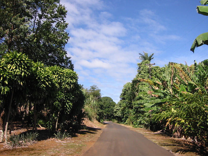
What a route. Superb. You ride through a tunnel of greenery – palms and ferns of considerable height, with the strong sun filtering through to light the road, which is very slippery indeed in places due to the fallen fern leaves and palm fronds rotting on the surface. There are a few steep and twisting, though short descents, where the road rounds a tropical gulch and you have to watch on these as they can be incredibly slippery. As you reach the bottom of the small gulch (the BIG ones come later!), you cross a tumbling stream of clear water running and dancing over smoothly worn volcanic rock. There’s an awkward bit of route finding when you come out of the forest, having passed the unfriendly access signs and you hit the suburbs.
At a T junction, turn left and this will eventually take to a nice wee store where you can stock up on tropical fruits and other goodies, ready for the run up HWY 19 to Honoka’a. From the shop, it’s a straight road until you meet a sharp left bend with a minor road heading right from it. Follow the bend left and you come back to the highway, right at a point with no shoulder!
There are plenty of places to leave the highway and follow the old Mamlahoa Highway, which is virtually traffic free and I turned left at the Umauma Falls sign for a nice detour and view of Mauna Kea across rolling green fields to cycle to the Waikaumalo Co. Park. This was a large wooden shelter in the deep shade of the forest, above the small burn and resonant with the song of a multitude of forest birds. There seemed to be some trails into the forest from here and the usual grafitti on the toilet walls but it was fine for a rest, toilet break and a bit to eat with the goodies I got from the shop on the Onomeia road.
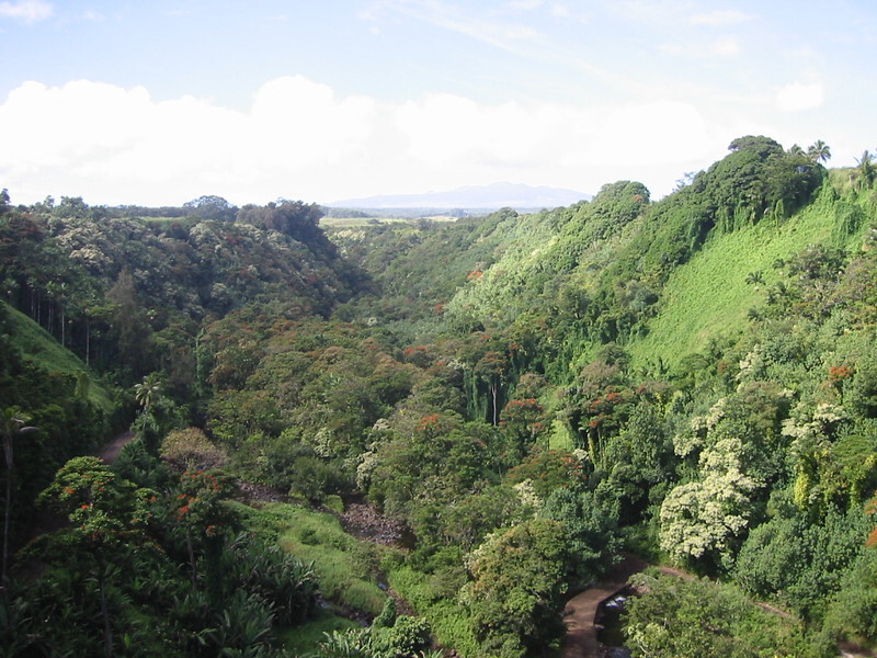
On, up the hill, over a wooden bridge which reeked of railways and tar and pine resin, an amazing smell indeed and back onto HWY 19 for the long climb to Honoka’a. Between Akaka Falls and Waikaumalo though, you experience the strange phenomenom of the Hawai’ian disappearing shoulder. One moment you’re screaming downhill at 30mph+ on a broad shoulder and the next you’re approaching a bridge, with no shoulder. What you have to do is made apparent by studying the parapet – it ramps at either end. You’re meant to cycle up the small ramp and cycle along the parapet, which is about 2 feet wide and cycle down the ramp at the other end to regain the shoulder. This necessitates a speed reduction of around 95% as the parapet is narrow, rough, some glass sometimes and on this stretch of road, you are passing over some seriously high bridges. The Erskine Bridge is nothing in comparison. One of these bridges was immense. I came fleeing down an incline to meet the bridge, slow down and bump up the ramp and immediately stare down to the tops of very tall trees, way way below in the gulch.
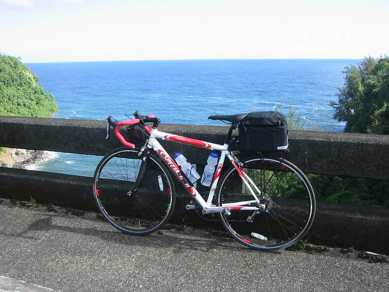
Then, as I moved out on the bridge, which was almost quarter of a mile long, the drop became higher and higher until in the middle, I couldn’t hear the river below, where it met the blue Pacific. I just had to stop for a picture, that and the fact that I was quite unnerved by the fact that the top of the parapet was at knee height as I cycled over the bridge! On the other side of the road, Mauna Kea rose majestically above the immediate steep slopes of tropical jungle, with the river penetrating deep into the heart of the forest, while away out on the other side, the blue blue Pacific stretched as far as the eye could see. What a place. That was the highest of the bridges but the others are just as intimidating and impressive and it became an art cycling across them, trying to keep on the parapet while balancing against the side wind and trying to take in the view at the same time!
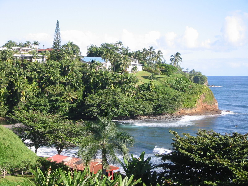
After Waikaumalo, you enter gulch territory, which consists of a short climb followed by a screaming twisting descent to the bottom of the gulch, round which the road bends sharply and there was a collection of flowers at every bend. It really is a frightening road, especially if you were driving and not expecting it. The descent is rather steep and at the bottom you don’t get much warning before the road in front disappears and you have to scream round to the right and up the next incline. Some of the gulches are inhabited and there were some very nice spots down by the shore, shielded from the road by the tropical forest and shaded from the sun by swaying palms down at the sea. One other minus point is the lack of a shoulder at the bend! I “took the lane” anyway as it takes a very wide and clean shoulder to keep me on it if I’m doing speed. So, it was out into the traffic, which was almost non existent anyway and a rapid application of the brakes at the bottom, trying to balance safety with a very big run up the next hill!
Past Waikaumalo though, the climb begins and you’re climbing steadily for about 12 miles, with a level section near the end. There was one steepish bit I remember but with a tail wind the whole way it didn’t really make much impact. The road is wide and fast, though the drivers stuck to the rigid 50mph speed limit and the shoulders are wide, clean and a delight to cycle on. You pass some beautiful paniolo country on this part of the route, with wide green fields of wind blown grass dipping down to the blue Pacific and you can really take them in as the effort is quite small with a raging tail wind!
The road eventually reaches Honoka’a high above the town and I was reluctant to drop down as we weren’t staying there that night, so some more climbing, which was by now quite tiring took me up onto the more level part of the highway and I popped into the Tex Drive. I knew our next B&B ,Mountain Meadows Ranch, was on the old Mamalahoa Highway, which started just opposite the drive-in so headed up the narrow, shoulder-less mountain road. I stopped at the top of housing estate to ask a local where the B&B was but he hadn’t heard of it. Not a good sign. Good surface but very winding and quite steep. It was a fair pech up into the forest. I passed all sorts of weird and wonderful houses with people peering out from the dark depths.
Eventually I stopped and asked a group of kids who were setting of fire crackers if they knew where the B&B was but they just gave me some very strange looks and stared at me. Then one of them just said “no” and they walked on, setting off more fire crackers. Then it dawned on me when I stopped at another house to ask directions and they couldn’t understand me – no-one around here could speak English! Eventually I knocked on another door and an English speaking couple of great age decided that I wanted the log cabin just up the road, which then turned out to be a holiday home and quite empty. Finally, past the small abattoir, I came to a junction and I called it a day and turned back for the fast descent to the drive-in as I had been climbing constantly for about 2 or 3 miles. I stopped once more at a steep rocky driveway where some locals were burning stuff and working on cars but due to the noise of their endeavours, I decded against another non-English confrontation and zoomed down, against the wind this time, to the drive-in and phoned the B&B. Dawn was already there and they pointed out my error – I had gone up the wrong end of the old highway! They were at the other end!
So, another 3 miles up the highway, under a canopy of massive trees and through immense cuttings for the left turn along the rough and rutted old highway to the B&B.
Now this was luxury. We had the entire ground floor almost, of a large wooden ranch house with a huge satellite dish outside and the fields were full of ponies and wild turkeys who were almost as big as the ponies. Mist swirled round the trees and we could hear the hoot and screech of tropical birds from deep within the swirling misty forest. Dinner was at Tex Drive-in in Honoka’a where I had two bacon and cheeseburgers – mistake, one was big enough and I really struggled to finish the other! We also got some malasadas, which are large doughnuts filled with different kinds of filling, such as jam or custard and all that. Very good for the bike.
The B&B is at 2500 feet and it was a cool night with some rain so we settled down in front of the telly and watched “The Green Mile” on DVD, while the TV faded in and out of colour!
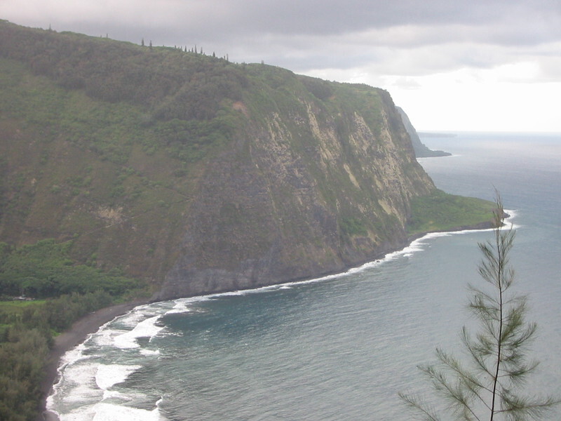
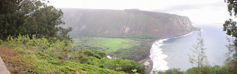
After dinner we had driven out to Waipio, past a lava cave at the side ot the road. Now Waipio is an impressive place and easy to get to by bike as the road is rolling and nothing too steep, though I couldn’t be bothered after the run from Hilo! The road stops at the overlook though and you’re strongly advised not to go down into the valley in anything other than a 4x4. I looked the road down and wondered why. It was smooth tarmac, steep and twisting but perhaps around the gradient of the Bealach na Ba coming Applecross but apparently the automatic hire cars can’t handle it and there are some huge drops if you slide off the road. What a place though. It used to be a very fertile, veritable utopia of the big island, supporting a large population in pardisic idyll, until a tsunami cam and washed it all away. Now you can stay in the valley in a tree house for an extortionate amount of money. Welcome touristville!